

X marks the spot
Patrice Baldwin
Monday, March 1, 2021
Patrice Baldwin, international Drama for Learning specialist, shares a key strategy for utilising drama maps
Adobe Stock/ Good Studio
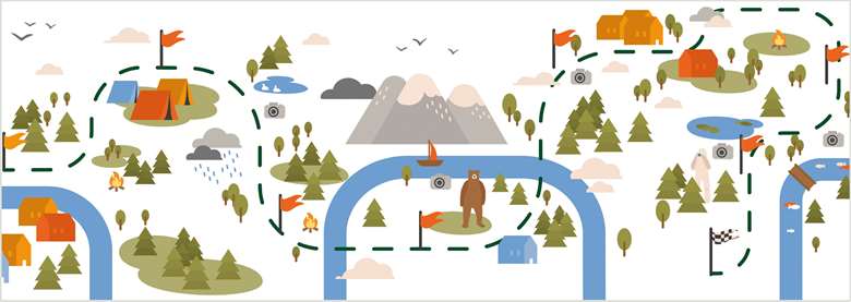
Maps are visual organisers. They can be created and used during drama lessons in various ways and do not have to be very detailed. Even a few features on a map can help set the scene and trigger the imagination.
Maps might simply show the landscape, some buildings and other places that matter to the imaginary community who live there. A map can be drawn and talked about in role by the members of an imaginary community. Maps can always be revisited and added to when more is discovered during the drama that is ‘map-worthy’.
Maps used in a drama are often co-created and co-owned. They may be drawn pictorially, labelled and/or created physically. Some maps in drama can even move and speak!
Mapping Storyland
Young children can map Storyland together with their teacher and can then travel there and explore it through drama. This is a good way of starting a whole class drama and links well with KS1 Geography.
The map of Storyland can be sub-divided into two main areas:
- The area where new stories are being made
- The area where stories have been made
The class and teacher will arrive together in one of the areas. As they will have already mapped Storyland together, they will all arrive with some shared ideas about what they can expect to find there.
When they return from Storyland, they will have explored it and maybe met characters there (often the teacher in role), so will then have new information that they can add to the map. They might also be able to show the route they took in Storyland on the map.
Students can individually or collaboratively draw the drama's journeys, situations and events in a chronological way as a linear story-map. They can draw a series of pictures, directional arrows, words, annotations, etc. and then use their story-map to support them when verbally recounting their visit, and maybe also writing about it.
Making the map for a drama
When students are exploring a known story through drama, they can be asked to start by making a map that shows the setting of the drama. They might do this from memory but could be asked to do it with reference to an actual text and/or relevant pictures of the story. Some picture books actually have maps in them, and these can be used during the drama, e.g. the Isle of Struay maps in the Katie Morag picture books. Also, when teaching history through drama, there are often historical maps that can be used as a starting point or during the drama.
The map for a drama is sometimes created completely freely before the drama starts, or the teacher might give the students some key information to guide their map-making, e.g. ‘The drama takes place on a heavily industrialised island, which you will now draw and label’.
Making the drama-map
Get a large sheet or roll of paper and felt pens. Each student draws one thing on the map and labels it. They speak about what they have added – maybe in role – for example: ‘My name is Martha. I have drawn the cottage I was born in. I now live here alone.’
Dorothy Heathcote often asked her students to draw maps or build models (3D maps) of the place, where the drama would be taking place. They sometimes did this using sheets, various materials and boxes and labelled the various buildings and places. They were invited to talk in role about the individual and communal significance of their various additions to the map/model.
Becoming the map
The students can physically become a map. They enter in turn and become the landscape features or a building, for example, and can speak as they position themselves, e.g. ‘I am the oldest tree in this land and I have a long memory.’ The map can also speak to or about various characters as they pass by.
Making sense of the map
A long paper map can be walked along. The students stand at the map's edges. The teacher walks on the map from one end to the other. As the teacher walks by, each student vividly describes whatever the teacher is passing on the map. Alternatively, they can be asked to make appropriate sounds as the teacher passes, e.g. the wind in the woods, a gurgling river.